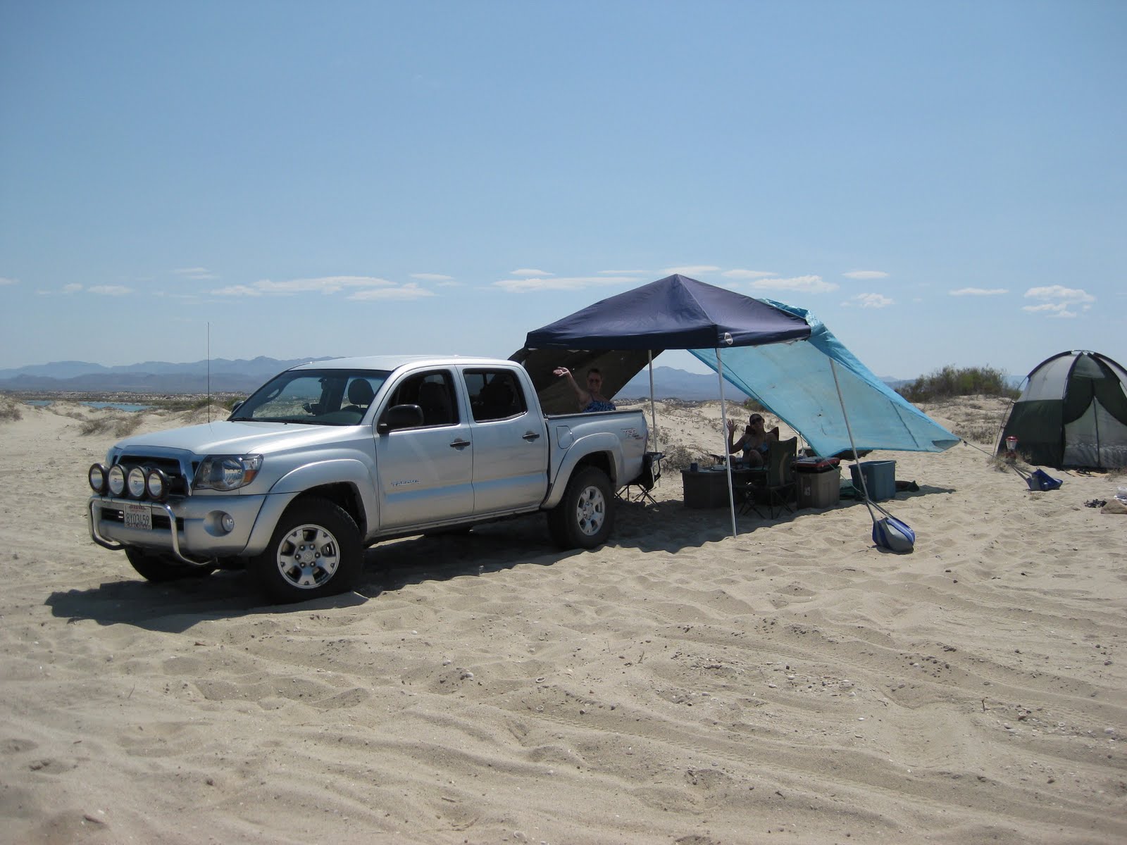
As things turned out, we had a fantastic first day (Saturday), but Saturday night severe winds whipped us and wrecked our sun canopy and tent. The result is we packed up and headed south a day early. The same wind capsized and sunk a fishing ship, the 'Erik', near Gonzaga Bay. We didn't hear of the tragedy until 2 days later on the news.
Saturday afternoon, Art and Nora in their new 4WD motor home arrived near our camp, but across the lagoon as the high tide covered the road onto the island. The next morning, they walked over the empty lagoon (low tide) and shared with us some delicious lumpias and ox tail soup! We all left the same time Sunday morning and headed south.
In El Rosario, we booked a room at the Baja Cactus Motel and had two very restful nights there before coming home. On Monday, we showed Kristi some of the sites around El Rosario and on Tuesday, we took a lunch break at the oak grove 3.8 miles west of Hwy. 1 in the Santo Tomas valley. This was the site of the first mission of Santo Tomas (1791), before it was moved after 3 years.


=========================================================================
SAN FELIPE TO LAGUNA CHAPALA:
The following road log was made on the July 4th weekend, 2011.
MILE / KM. Marker
0.0 San Felipe (Traffic Circle by Pemex stations, south turn)
0.8 Pemex station and market on south side of town
6.0 Left Turn off Airport Road, Km. 0
-----------------------------------------------------------------------------------------
(add 6.0 miles to following for distance from traffic circle)
The next 45 miles are well paved, but many short, steep and unmarked dips will require reduced speed to avoid damage.
0.0 / Km. 0 Airport Road/ Puertecitos Road Jcn.
12.5 / Km. 20-21 Rancho Percebu Road
15.7 / Km. 26+ Shell Island Road
18.6 / Km. 31 Bahia Santa Maria Road
19.3 / Km. 32+ Nuevo Mazatlan Road
21.5 / Km. 35.5 Colonia Delicias (markets/ restaurants)
29.6 / Km. 49 El Coloradito Road
32.8 / Km. 54 Campo Cristina Road
35.4 / Km. 58.5 Los Olivos Road
36.1 / Km. 60 Arroyo Matomi
36.3 Rancho San Rafael (well)
43.4 / Km. 72 Playa Destiny
44.9 / Km. 74+ PUERTECITOS (paved) Road
---------------------------------------------------------------------------------------
The newest paved additions to Hwy. 5 are well engineered, wide and are designed and signed for high speed. However, frequent rock slides onto pavement require caution.
0.0 / Km. 74+ Puertecitos Road
5.0 / Km. 83 Bahia Cristina
6.1 / Km. 84.5 La Costilla
7.2 mine road
16.4 El Huerfanito Road
18.9 Bridge at previous end of pavement (July 2010)
20.1 / Km. 311 Change of Km. markers, distance from Mexicali
23.6 / Km. 317
24.1 / Km. 318 END OF PAVED DRIVE, detour onto older road, regraded smooth. Pavement ends just ahead on new roadbed.
25.5 Okie Landing site.
32.0 END OF NEW ROAD CONSTRUCTION and end of smooth dirt detour on older road.
32.4 Campo Delfines Road
35.6 Las Encantadas Road
37.7 Punta Bufeo Road
42.4 Papa Fernandez' Road, roadbed south of here is better/ faster.
43.6 Miltary Checkpoint
45.0 GONZAGA BAY PEMEX/ ALFONSINA'S ROAD/ RANCHO GRANDE MARKET (Pemex closed from 2-4 pm for siesta)
---------------------------------------------------------------------------------------
0.0 Gonzaga Bay Pemex
1.2 Campo Beluga (2.0 mi.) and El Sacrificio (4.2 mi.) Road
7.1 Las Palmitas Oasis (4.7 mi.) and Santa Maria Canyon (4.0 mi.) Road, right.
14.4 First Boojum Trees on Hwy. 5.
14.6 La Turquesa Canyon Road, right.
18.4 Las Arrastras (site) Road, right.
22.1 Coco's Corner (Puerto Calamajue and Mision Calamajue road left).
34.8 Hwy. 1, Laguna Chapala (Cataviña is 33 miles north).
No comments:
Post a Comment